There is a long history of open data in seismology, which has been fundamental for a science where the ‘experiments’ often rely on access to measurements of ground motion around the world. For infrasound science – the study of low-frequency acoustic waves, and another science that relies on global measurements – open access to data has been very limited until recently. The figure below shows the locations of infrasound sensors that anyone can access data from; most of this data has become available only within the past few years. In particular, the figure highlights two global networks: the Global Seismographic Network (GSN) and the International Monitoring System (IMS).
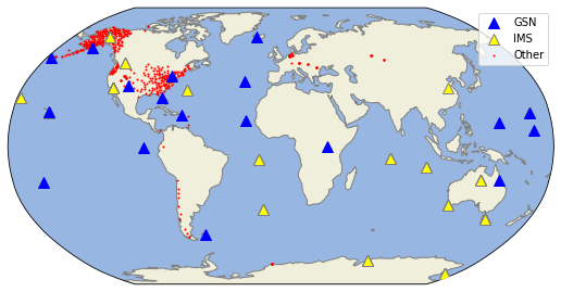
The GSN is an important long-running global seismic network that contains state-of-the-art observatory style seismic installations. Because these installations contain a lot of infrastructure that can support other sensors, the GSN started adding infrasound sensors to a few of their stations (these are the blue triangles in the figure). I didn’t realize this until I was asked to participate on a panel exploring the future of the GSN, but most of these stations have been running since at least 2018.
The IMS is a global network that is being installed as part of the verification regime for a possible Comprehensive Nuclear Test Ban Treaty. The stations in the network are run by member countries, but the data are not required to be openly available to any individual under the treaty (a real shame for science IMHO). However, a few countries have made their data available to anyone, and these are shown as the yellow triangles on the map (I should add here that the Comprehensive Nuclear Test Ban Treaty Organization have created a portal where researchers can access the data: https://www.ctbto.org/specials/vdec/, but this is only under a specific project and no-fee contract with CTBTO. In practice, it doesn’t constitute open data. My university, for instance, is not willing to sign the contract.).
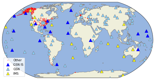
The state of open data in infrasound today is improving, but it could be so much better with some investment. The global distribution of stations remains limited, and the makeup of these stations is very variable. In particular, only the IMS stations contain arrays of sensors, which are particularly important for infrasound science. However, many IMS stations do not contain seismometers, which are often useful together with infrasound sensors, whereas the GSN stations do! This mishmash is frustrating. I’m not optimistic that the IMS stations from more member states will become available soon, but there may be the opportunity to add infrasound sensors to additional GSN stations, which could significantly fill out the map above, as shown below. In addition, making as many of these stations into arrays could be a game changer.
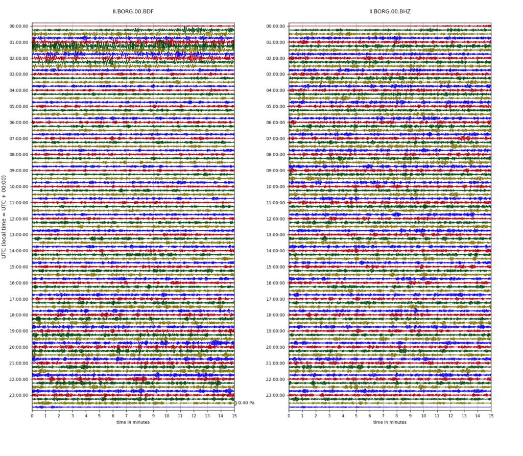
Infrasound sensors measure signals from all sorts of natural and manmade events, but I want to highlight one signal they record almost continuously: the sound of the ocean. The figures below show measurements of acoustic pressure and ground motion at the GSN station in Iceland (a station called BORG). These measurements are filtered to accentuate signals (which looks a bit like noise here) generated by the interaction of wind-driven ocean waves.
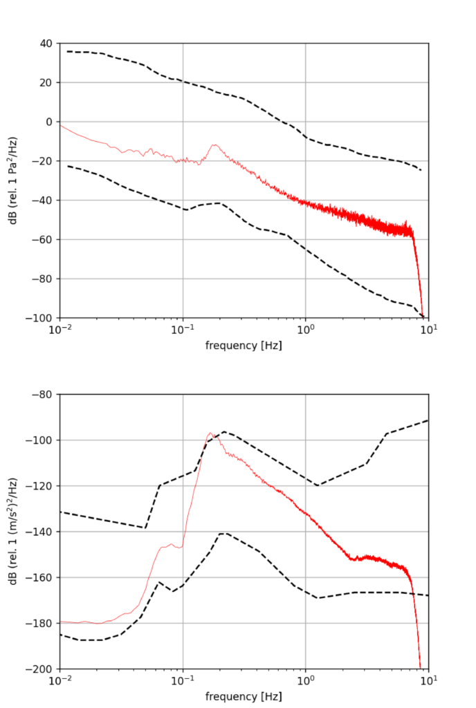
The signals can be seen more clearly if you look at the signal power as a function of frequency (see below). In this case, both spectra peak at a frequency of ~0.2 Hz, or around 5 s period. This peak is particularly pronounced at BORG, as Iceland is located near a large source of wind-driven waves in the North Atlantic.
It’s a pretty good thing that our ears aren’t sensitive to these sounds, or we’d hear this background cacophony from the ocean almost continuously. However, infrasound sensors can let us hear these signals. These acoustic waves are thought to play an important role in the heating of the upper atmosphere, possibly raising the temperature of the mesosphere/lower thermosphere by several 10’s of Kelvin per day, thus playing an important role in the energy budget of the atmosphere. With networks of sensors, they could also be used as a potential continuous source for ambient noise interferometry, a technique that has gained widespread application in seismology recently.
The first truly global network of seismometers, which was deployed to monitor nuclear tests, led to data that played an important role in developing the theory of plate tectonics, in particular through enabling the mapping of seismicity along the plate boundaries. The story of this development highlights an important point: we can’t always anticipate what science will be made possible by new openly available data, especially when that data are fused with other observations for new purposes. This is partly why I’m advocating for the addition of infrasound sensors to all GSN stations, providing us with a first open global infrasound network.